Edward Cockrem & William Elliott
A Guide to Torquay containing General History and Antiquities, explanation of the Panorama from Park Hill, Geology, Climate, Parochial Government, Religious and Charitable Institutions, Public Establishments, Miscellaneous Directory.
Torquay: E Cockrem and W Elliott: 1841.
.jpg)
.jpg)
.jpg)
.jpg)
.jpg)
.jpg)
.jpg)
.jpg)
.jpg)
The second “map” published by E Cockrem is not strictly a
map. However, it is more than simply a view and the accompanying text makes it
clear that there was a sense of orientation and perspective and was clearly a
guide of sorts. It reminds one vaguely of the map of Devon produced by George
Bickham in 1750 (B&B 36) where a rider poses before a view of the county stretching
away behind him. That illustration was a classic bird’s-eye view. Here we have
a 360° panorama of the area around the viewer. The accompanying text in the
small book[1]
is clearly that of a tourist guide with all the information one would expert to
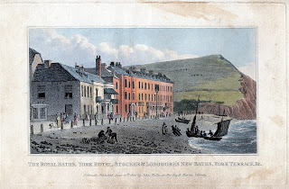
be present. Besides the panorama there were 9 attractive oval vignette views[2].
William Elliott was possibly born in Plymouth as he served an apprenticeship
in Plymouth Dock under Lazarus Congdon[3],
stationer and publisher and proprietor of the Dock Telegraph (1812). Elliott’s addresses in Torquay were Vaughan Parade (1840-1855) and 2, Lawrence
Place (1856). He was proprietor of the Torquay Chronicle in 1856. Somers
Cocks dates one engraving of Watcombe near Torquay by Smart and published by
Elliott to 1830 making it his earliest recorded work. Elliott has been reported as working with
Cockrem from about 1834 and but they only
seem to have cooperated on this one project in 1841[4].

Size: 200 mm in diameter. No
scale.
PANORAMA FROM PARK HILL (centrally) surrounding a compass with north point. Surrounding the
title is a "clock" type scale with numbers from 1 to 19. No imprint
or signature.
When the panorama is held with north to the top the number 4 is also
top. Around the central circuar panel is a birds-eye view giving a 360°
panorama from the summit of Park Hill. The map has no labeling but the features
are identified by the number ring and the accompanying text.
[1] Only 130 x 105 mm the guide
ran to 90 pages plus an Appendix with a further 13.
[2] See Somers Cocks entry S.152.
[3] Listed in Universal British Directory 1792-98 and in
Holden’s Directory (1811). Both he
and a John Congdon, also stationer, are listed in The Picture of Plymouth (1812) in Fore Street, Dock.
[4] Somers Cocks lists three engravings
for each person and none are signed by both together.
.jpg)
Comments
Post a Comment